
PANHANDLE
WaterColor
fishing guide
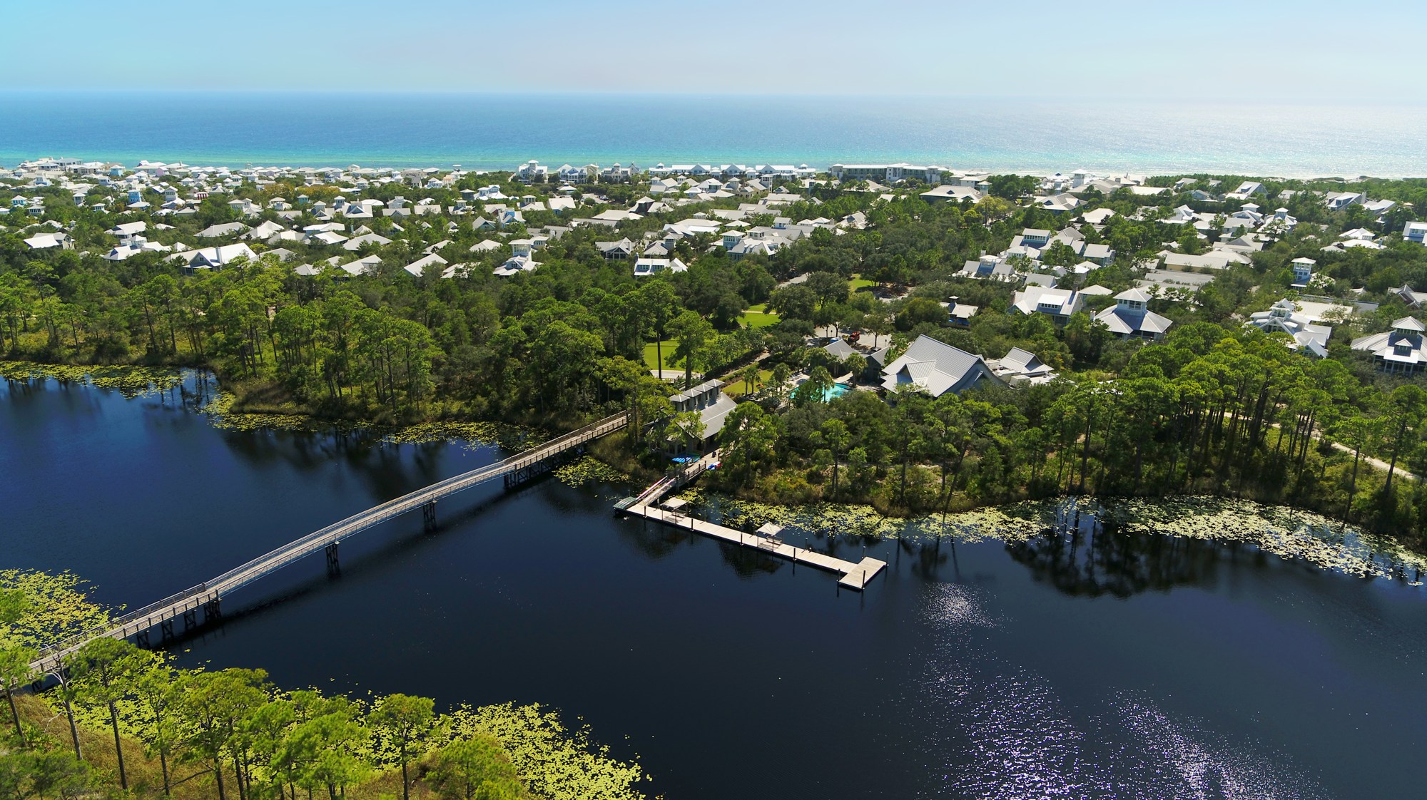
WaterColor sits beside Gulf surf and the Western Lake landscape. Its managed guest areas and nearby public routes need to be distinguished before fishing. Choose an authorized setting and one suitable presentation rather than assuming every beautiful shoreline is available.
Explore the guide ↓Confirm the rights that come with your stay
WaterColor is a managed resort community, with beach and lake recreation connected to specific access arrangements. Ask the accommodation or activity manager which route you may use and whether fishing is permitted there. A stay in the wider area, dining visit or public shopping parking does not answer that question.
Keep the plan precise about the Gulf frontage, a lake activity or a separate county access. Do not assume a guest beach privilege also covers every dock or lake bank. Current manager instructions should settle a route before tackle is unpacked. An old visitor account can describe a different property or an arrangement that has changed.
Check a separate public route when guest access is unclear
Walton County's current official access map can identify nearby public Gulf entries and their boundaries. Grayton and Seagrove regional entries are separate alternatives to investigate, each with its own present notices. Choose the exact public destination instead of treating the WaterColor town name as a public beach entrance.
If planning Grayton Beach State Park for a lake or Gulf session, confirm its current reopening notice independently. An open county beach does not mean a state park is open. Likewise, a public parking opportunity near shops does not establish fishing rights on managed waterfront. Keep the travel and activity permissions distinct.
Use wave patterns for a focused surf test
On an authorized Gulf stretch, watch several sets to locate a sandbar and adjacent trough. The shallow breaking line can reveal a depth change where small prey travels. Start with a cast you can repeat accurately into the nearer lane. Range only matters when it reaches a feature worth testing.
Cloud shadows, suspended sand and vegetation can all darken water without indicating a deep hole. Compare color with how waves behave. A gap through a bar can also carry a strong offshore return flow. Keep the fishing position on stable sand and do not wade along a channel to gain distance.
Test small food for whiting and seasonal pompano
A modest shrimp piece makes a useful general surf offering. Sand fleas or compact bait strips provide a different test for passing pompano. Choose a hook suited to the bait and keep the point uncovered. A large bundle can spin, fold or be stripped before a fish is properly hooked.
Keep the reserve cold throughout the approach from the accommodation or public lot. Frequent retrievals show whether the bait survives the wash. If it is removed quickly, shorten checks and try a tougher offering. If it remains untouched, compare a second trough position rather than making several unrelated equipment changes.

Fish a lake edge only after the route is approved
Western Lake's coastal dune setting calls for observation and specific permission. A view of water from a path does not make it an approved casting spot. At a confirmed legal position, inspect cover, clarity and visible prey. Do not assume the same fish mix or salinity at every part of the lake or on every date.
A small soft plastic can search an open bottom edge. Suitable bait beneath a float can stay above vegetation when actual water and target conditions support it. Adjust weight or float depth if the hook returns fouled. Avoid forcing a boat or paddle through shallow plants to reach a more distant uncertain bank.
Keep the equipment useful on the route
A long surf rod may be awkward on a lake dock or narrow walkway, while a lake outfit may not safely cast a heavy Gulf sinker. Select the main environment and pack for it. Secure hooks during walks past families and bicycles. One focused kit keeps the outing calmer than carrying several incompatible outfits.
Pliers, a measure and closed tackle-waste storage belong close to the landing area. Take enough water even when the accommodation is nearby. The table connects each plan to its first verification, preserving the difference between good-looking habitat and an actual permitted fishing opportunity.
| Intended plan | First verification | Useful approach |
|---|---|---|
| Managed Gulf frontage | Current guest route and activity rules | Compact surf bait in a clear trough |
| Lake bank or dock | Exact permission and open position | Gentle presentation clear of cover |
| An approved paddle outing | Launch and return arrangements | Short route with flotation device |
| A county alternative | Named access and public boundaries | Separate current beach safety assessment |
Compare the settings before changing the plan
Gulf wind and waves can make a surf rig difficult even when a nearby lake corner looks calm. That lake may still have a windy open reach on a paddle route. A weather-driven switch must include a new permission and safety check. It should never become an excuse to step onto a private bank or closed park.
Spring and fall often draw coastal pompano interest, while summer increases heat, storms and swimming activity. Cooler fronts can change clarity quickly. Tide predictions help with coastal scheduling but do not dictate a universal lake pattern. Use the actual water movement and a conservative return time to guide the day's method.
Use current species rules and leave the route clean
Identify a catch accurately and verify current size, season and bag conditions before retention. Confirm licensing for the chosen water and activity rather than deciding from the community name. Release uncertain fish promptly, supported with wet hands. A fish in the photograph from a past visit does not establish today's permissions or harvest rules.
Remove leaders, damaged hooks and all personal belongings before returning through the crossing or walkway. Do not leave an outfit to hold a space for later. WaterColor can support an enjoyable coastal visit when the fishing part remains specific about access, careful about habitat and modest about the shared space it uses.
Common questions
Can anyone fish WaterColor's beach and lake areas?
Do not assume so. Confirm the exact access and activity conditions with the manager, or choose a separate named public destination.
Does a lake view from a trail establish a fishing bank?
No. A scenic route and an authorized casting position are different things.
Can I use Grayton Beach State Park as an automatic alternative?
Check its present reopening and entry conditions first. A nearby open beach does not prove the park is open.
What is the best way to keep the outing simple?
Choose one confirmed setting and one manageable method, with secured hooks and a clear return route.
Prepare for your visit
Check local tides and weather. Read more about florida pompano, permit. Check current FWC saltwater fishing rules.