
BIG BEND / NATURE COAST
Crystal River
fishing guide
Find designated shore fishing and understand the wider estuary. Keep fishing plans separate from protected springs and manatee areas.
Explore the guide ↓SPRING WATER, A TIDAL RIVER AND COASTAL MARSH
Look beyond the springs for your fishing plan
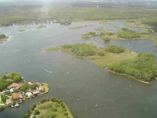
Crystal River connects the spring-fed waters around Kings Bay with an estuary and the Gulf coast. The clear upper water, tidal river and outer marsh do not fish the same way. Choosing the right part of that system makes the trip easier to understand.
This guide focuses on lawful public fishing access and coastal habitat. Manatee viewing areas and protected spring sanctuaries are not fishing destinations. Follow all posted sanctuary boundaries and restrictions, including temporary closures.
You can begin from shore without treating the entire river as one large search area. The state preserve identifies specific fishing places, while established ramps support a more involved boat outing.
Named shore options at Crystal River Preserve
Mullet Hole
The state park identifies Mullet Hole as a fishing area reached from the first driveway on the left after its main gate on Sailboat Avenue. It follows a canal system connected to the river. Check signs and remain within the designated area.
Redfish Hole
The park lists the Redfish Hole entrance off Fort Island Trail near mile marker 4. Reaching the fishing area involves about a half-mile walk. It is a tidally influenced former borrow pit. The park notes that there is no drinking water or restroom there, so carry what you need.
Near the administrative office
The preserve also lists fishing in the inlet across from its administrative office. Confirm the permitted position on arrival and keep visitor and boat routes clear. This is separate from assuming any bank beside a trail is a fishing access.
The Eco-Walk is a nature trail, not the name of these fishing areas. Use the actual access name when setting directions.
Choose a ramp for the water you intend to fish
The city lists the NW 3rd Avenue launch at 558 NW 3rd Avenue and the privately operated Pete’s Pier at 1 SW 1st Place among local launching choices. Fees, parking and operating arrangements differ. Confirm the specific ramp rather than assuming all listings are city-operated.
Launching near Kings Bay does not mean the outer coast is a short, simple trip. Plan the river transit, speed zones, weather and return. Keep a careful lookout for manatees and obey posted vessel restrictions.
If your goal is a short shore session, do not turn it into an improvised boat rental trip because the first spot is quiet. The wider estuary deserves its own preparation.
Follow the change from marsh to deeper water
Coastal marsh, mangrove edges, grass and sandy channels provide different feeding opportunities. Fish may hold where one meets another. A small opening in cover can be more useful than an uninterrupted bank.
Approach quietly and cast beyond the likely holding position. Let a lure pass the edge instead of landing it directly on top of a visible fish. Avoid pushing a boat into roots or grass to gain a few feet of casting distance.

Fish and presentations to consider
| Fish | Where to concentrate | Try first |
|---|---|---|
| Redfish | Marsh turns, shell edges and tidal feeding lanes | A shrimp or weed-resistant soft plastic |
| Spotted seatrout | Grass near sand pockets and depth changes | A lightly weighted paddletail |
| Snook | Suitable cover with nearby moving water | A small baitfish imitation presented close to the edge |
| Flounder | Sandy bottom beside a channel | A slow lure kept near the sand |
| Sheepshead | Hard structure and shell | A small crustacean bait with controlled weight |
Species availability changes with temperature and the part of the estuary. A fish list is a starting guide, not permission to enter a closed refuge area or a promise about the day’s catch.
Make shore casts count
At a designated canal or inlet fishing area, begin by observing current and depth. Use a short cast to learn how quickly the lure sinks and whether it contacts vegetation. Then extend the cast toward a useful edge.
A small shrimp can be fished beneath a float where the bottom is snaggy. In deeper open water, a lightly weighted rig may give better contact. Adjust the presentation to the place instead of carrying a single heavy rig everywhere.
If you catch grass, clean the hook and change the depth or weight. If you catch hard bottom repeatedly, alter the angle. A lure that returns clean gives you a fairer test of whether fish are interested.
Choose a landing position before hooking a fish. Steep banks, roots and high edges can make the final moments awkward. A small net often solves the problem more safely than reaching down with a bent rod.
Seasonal movements without chasing protected water
During cooler weather, fish may favor more stable temperatures and nearby depth. That does not make a manatee sanctuary a fishing opportunity. Use designated fishing places and respect all active closures.
Spring warming can make outer edges and shallower habitat worth exploring. Look for bait and clean presentations. A cold front can interrupt the pattern, so keep a sheltered alternative.
Summer brings heat and heavy recreation in parts of the river. Start early, obey speed zones and leave plenty of space around swimmers and paddlers. A coastal fishing route should avoid busy viewing areas.
Fall can reward a search along tidal edges as conditions become more comfortable. Fish several nearby features carefully instead of making long runs between distant locations.
Spring flow does not remove the tide
The system includes spring water, but the river and estuary still respond to coastal water movement. Wind and tide can change depth, current and clarity. A clear upper basin does not tell you what conditions are like near the Gulf.
Check tides and weather for the area and plan the whole return journey. On outer flats, leave enough water to avoid grounding. In the river, allow time for posted slow-speed areas.
Do not use a habitat illustration or a satellite image as your only navigation aid. Current charts and careful observation are essential when moving among shallow channels.
Keep wildlife and fishing separate
Never cast toward a manatee or use bait to attract wildlife. If a protected animal approaches your line, stop the presentation and avoid creating an entanglement. Keep hooks and discarded line secured.
For a walking trip, carry water, insect protection and a compact tackle selection. Tell someone the access you plan to use. Return fish with wet hands and avoid placing them on rough ground.
Consult the Florida Fish and Wildlife Conservation Commission for current harvest and license requirements. Local refuge and park restrictions apply in addition to general fishing rules.
Make a quiet cast beside cover
Clear water can make fish easier to see and easier to alarm. Stay back from the edge when possible. Cast beyond the holding area and bring the lure through it instead of dropping the lure directly onto a visible fish.
A small baitfish-shaped lure should swim straight. Check that the soft plastic is rigged evenly before changing colors. A twisted lure may spin or move unnaturally even when the size appears right.
Near roots or rough cover, keep the leader strong enough for the intended target and inspect it after contact. That does not mean turning every light inshore setup into heavy tackle. Use an outfit that can guide the fish away from cover without an unnecessarily long fight.
For snook, steady control and a prompt, supported release are especially useful habits. Do not lift a heavy fish by its lower jaw alone. Keep the body supported and the photo brief.
Prepare differently for a walk-in fishing area
A half-mile walk changes what belongs in the tackle bag. Carry water, pliers, spare leader and a compact bait or lure supply. Leave equipment you will not use behind rather than turning the return into a heavy haul.
Inspect the landing area before beginning. A bank can offer easy casting and awkward fish handling. Choose a position where you can use a small net or release fish without climbing onto unstable ground.
Footwear should suit the path and bank. Do not step into unfamiliar water to retrieve a snagged lure. Soft bottom, vegetation and hidden shell can make a short reach much less simple than it appears.
Keep insect protection and sun cover available even on a short visit. A shaded path can lead to an exposed fishing edge. Tell someone which named access you intend to use and when you expect to return.
Choose one nearby alternative
If the first designated area is closed or unsuitable, use another verified public option. Do not follow an unmarked trail simply because it points toward water. A preserve contains places meant for different activities.
Compare the conditions at the second area rather than expecting the same rig to work unchanged. A canal, inlet and tidal pond can differ in depth and flow. Let the bait move cleanly through the actual water in front of you.
Keep sanctuary rules separate from fishing success. The presence of fish in restricted water does not change the boundary. Good local knowledge includes knowing which attractive-looking places must be left alone.
Crystal River questions
Can I fish at Three Sisters Springs?
Do not treat it as a fishing destination. Follow refuge and sanctuary restrictions and choose designated fishing access elsewhere.
Is Redfish Hole right beside the road?
The park describes about a half-mile walk from the entrance. Bring water and keep the gear load manageable.
Is all the river freshwater?
No. The system connects spring-fed water with a tidal estuary and the coast. Conditions vary along the route.
Can I catch coastal species from shore?
Suitable designated access can provide opportunities. Match the bait and depth to the specific place rather than expecting every coastal fish at every bank.