

FLORIDA KEYS & EVERGLADES
Chokoloskee
fishing guide
Fish beside oyster bars from known depth, arrange launch permission and choose a short route through the island waterways.
Explore the guide ↓Fish the edges of an oyster-and-mangrove landscape
Chokoloskee is a small island community beside a much larger maze of tidal water. Oyster bars, mangrove islands, shallow bays and winding channels shape the fishing. Redfish and snook are central targets, while mangrove snapper and seatrout offer other possibilities where depth, cover and salinity fit.
The best starting question is not how far to travel. It is which nearby habitat you can reach and leave safely at the day’s water level. A short route with a clear channel can provide more useful fishing time than a distant run through unfamiliar shallows.
Shore access is limited compared with the amount of water visible from the island. Much of the waterfront serves homes, accommodations or private marinas. Arrange access directly and do not treat an open-looking dock as public property.
Confirm the launch before towing a boat
Private facilities provide important boat access on Chokoloskee. Outdoor Resorts of Chokoloskee lists a marina with a boat ramp and a kayak or canoe beach ramp. Confirm day-use availability, fees, hours and parking directly before relying on it for a trip.
Other local marina services may offer docking or launch arrangements, but their terms are not interchangeable. A slip rental is not necessarily a public launch pass. Ask specifically about the vessel, trailer and length of parking you need.
For national park information and a listed kayak launch, the Marjory Stoneman Douglas Visitor Center is in nearby Everglades City. That is a separate starting point with a different route to fishing water.
Prepare tackle and safety gear before occupying a ramp. Keep fishing lines away from boarding docks. If the intended launch is unavailable, use a confirmed alternative rather than backing into an informal shoreline opening.
Read an oyster bar without crossing it
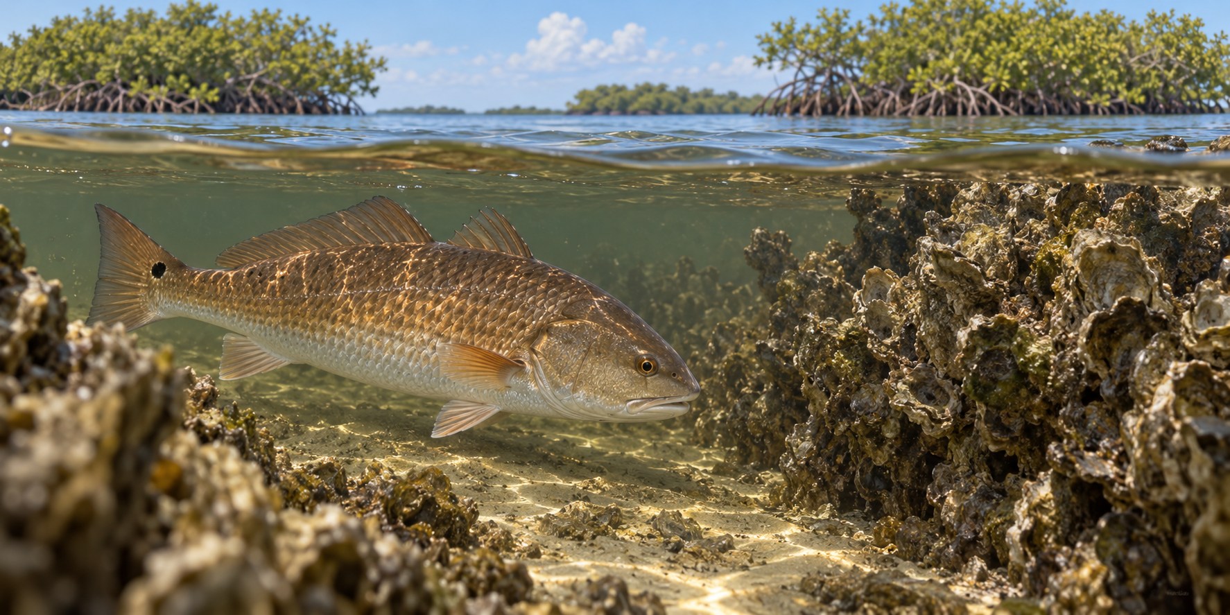
An oyster bar is both habitat and a navigation hazard. At lower water it may show as rough exposed shell. At higher water it can disappear beneath a surface that looks easy to cross. The edges and gaps can concentrate small prey and create feeding opportunities.
Keep the boat in known deeper water and cast toward the outside edge. A redfish can search the nearby bottom while remaining close to a channel. Snook may use a point where current passes the bar and mangrove cover.
Do not wade onto shell to retrieve a lure. Cuts, soft bottom and changing current make that a poor trade. Use a presentation that can work above or beside the roughest cover.
Choose a target and one clear presentation
| Fish | Feature to search | Bait or lure | Presentation detail |
|---|---|---|---|
| Redfish | Oyster edge with a nearby deeper escape route | Shrimp or weedless shrimp imitation | Move slowly along the clean side of the shell |
| Snook | Current seam at a point or creek mouth | Paddletail or minnow-shaped lure | Let the lure pass the edge at a natural angle |
| Mangrove snapper | Roots beside a deeper channel | Small shrimp or compact cut bait | Keep contact and react to short quick bites |
| Seatrout | Open grass with sand pockets | Small jig worked high, or a floating shrimp presentation | Drift the offering above vegetation |
| Tarpon | Suitable tidal channels with room to fight | Purposeful heavy-enough tackle | Choose a release plan before making the cast |
Do not move directly from a small snapper rig to targeting a large tarpon. Match the tackle and handling plan to the fish rather than hoping the lighter outfit will be enough.
Approach before you cast
Shallow fish can detect a hull bump, paddle slap or dropped tackle box. Stop well short of the feature and let the water settle. Make the first cast count instead of using several noisy casts to find the distance.
Position so the wind helps rather than pushes the boat onto the bar. If you cannot hold outside the cover comfortably, choose another angle or another stop. Boat control is part of presenting the lure.
A weedless lure can reduce snags, but it is not permission to drag through mangrove roots. Work the open lane beside cover. When a fish follows without striking, try a pause or a different speed before changing every piece of tackle.
Keep a second simple option ready, such as a small jig for more open water. That lets you test a nearby channel edge without rebuilding the whole outfit.
Water level controls both fish and travel
Falling water may pull prey from shallow edges toward channels. It also exposes bars and reduces the depth available for a return route. Watch both effects together.
Rising water allows fish to spread across newly covered feeding ground. A shoreline that looked empty at low water may become useful later. Look for movement along the outer edge before entering a shallow pocket.
The tide and weather forecast is a planning aid, not a depth guarantee. Wind and the connected waterways can change the timing and height you experience.
If the bottom is getting closer faster than expected, leave early. Waiting for one more fish is not worth grounding a boat on shell or damaging seagrass.
Adjust to fronts, rainfall and heat
During cool spells, protected channels and nearby deeper holes can be more useful than exposed shallow flats. Slow down the presentation and give a fish time to respond. A sunny period may improve a shallow edge later in the day.
As spring warms, search for bait around points and current seams. Fish may use the same general area differently as water levels change. Keep notes about the tide stage rather than only the date.
Summer brings strong reasons to shorten the route. Heat, biting insects and thunderstorms can make a remote trip demanding. Carry ample water and plan a return well before a forecast storm period.
After heavy rain, salinity and water color may shift. Search connected habitat rather than assuming a familiar bar must still hold the same fish. The useful question is where the bait and tolerable water have moved.
Account for national park requirements
Many routes from Chokoloskee enter Everglades National Park. Check park boundaries, the motorboat education and permit requirements, and any current area restrictions before departure.
Park bait rules change between saltwater and freshwater settings. Some facilities and wildlife areas also have specific fishing limits. Read the applicable guidance for the water you intend to enter rather than applying a general coastal rule everywhere.
A beach or island that looks empty is not automatically a legal landing or campsite. Plan stops through current park information. Keep wildlife undisturbed and leave no bait containers, line or food scraps behind.
A first outing with two useful stops
Begin with a known channel and an adjacent oyster edge. Fish the edge from deeper water, then compare a nearby mangrove point with similar current. That gives you a meaningful test without a long run.
Notice where strikes occur. A fish caught just outside the shell suggests a different next cast from one taken beside deep roots. Repeat the successful relationship at another safe nearby feature.
Keep the final part of the outing for an unhurried return and ramp retrieval. A well-learned short route is a better foundation for future fishing than a confusing tour through many islands.
Release fish where they can recover
Consult the FWC saltwater regulations for current licenses, seasons, sizes and limits. National park requirements apply alongside those state rules.
Bring fish to hand efficiently and keep them supported. Avoid shell, dry mud and hot decking during release. If dolphins or sharks begin taking hooked fish, move away instead of repeatedly exposing more fish to the same problem.
Use the bar as a reference, not a destination
Choose a visible point on the oyster edge and make a cast that passes beside it. On the next cast, alter the angle slightly while keeping the same distance. This tests how current carries the lure without moving the boat into the shell. If every retrieve snags, the lure is spending too much time in the roughest part. Raise it, lighten it or work farther outside. A clean presentation beside habitat is more useful than repeated lost tackle inside it. Keep track of water level during this small experiment because the gap you are fishing can narrow as the tide falls.
Chokoloskee questions
Is there unlimited public bank fishing?
No. Much of the island waterfront is private or used by marinas. Confirm permission at a designated location.
Can I walk across an exposed oyster bar?
That is a poor way to reach fish or retrieve tackle. Sharp shell, soft bottom and changing water make it hazardous.
Does a GPS track guarantee a safe return?
No. The same route can become too shallow at another water level. Keep depth and tide in the decision.
Where are launch and park references recorded?
The Chokoloskee source notes include the marina, park and photograph records.