
FLORIDA KEYS & EVERGLADES
Cudjoe Key
fishing guide
Check Blimp Road status before towing, then choose a modest backcountry route or a properly prepared legal reef trip.
Explore the guide ↓Choose the bayside or Atlantic side deliberately
Cudjoe Key gives access to two very different Lower Keys settings. To the north, shallow backcountry water and mangrove islands call for careful routes and quiet fishing. To the south, channels lead toward Atlantic habitat, including reef areas with their own rules and weather demands.
A route that looks short on a map may cross shallow bottom, open water or protected areas. Choose the side that suits your vessel and experience before choosing the fish. Mangrove snapper, bonefish, permit and reef fish belong to different versions of the trip.
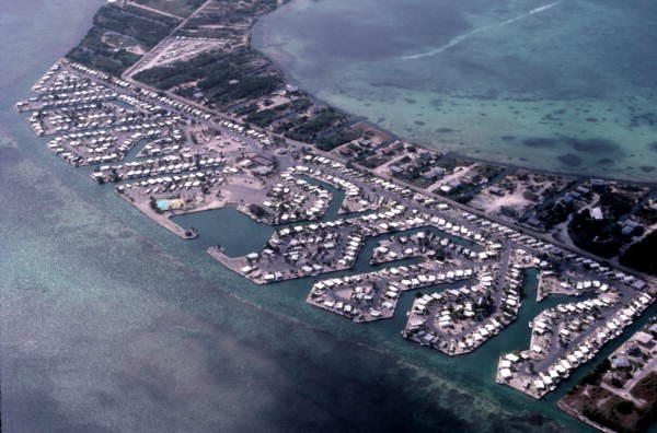
The island also contains extensive private waterfront. The photograph of Venture Out shows a developed waterfront community, not a public fishing entrance. Confirm access before approaching residential docks or resort facilities.
Verify Blimp Road before relying on it
Monroe County lists Blimp Road as a public ramp on Cudjoe Key’s bayside. However, a February 2026 county notice announced a temporary closure for staging environmental work connected with Tarpon Belly Keys.
The notice gave an estimated reopening before the late-July lobster mini-season. An estimate is not confirmation that the ramp has reopened. Check the current county facility status directly before towing or planning a kayak launch there.
If it is unavailable, arrange another confirmed launch and recalculate the route. Do not use a nearby private shoreline or an unmarked road end as a substitute. Parking and launch permission must both be clear.
Even when open, the ramp’s location does not make every nearby flat passable. Study the channel and water level, prepare the boat before occupying the ramp, and leave room for other users.
Keep the northern route small at first
The backcountry can look like a wide calm sheet of water, but shallow banks and channels determine where a boat can travel. Wind can make a long return across open flats tiring or unsafe.
Begin with a short route close to known water. Search a mangrove edge or channel margin rather than aiming immediately for distant islands. Look back at junctions so the return view becomes familiar.
Refuge lands and wildlife areas add access limits. Do not assume an unoccupied island is available for landing or a picnic. Follow current refuge maps and signs, and leave resting birds undisturbed.
For a kayak, wear a flotation device and keep communication accessible. A phone sealed deep in a bag is less useful when needed quickly. Carry water and allow a generous margin for wind on the return.
Understand reef habitat before choosing a fishing position
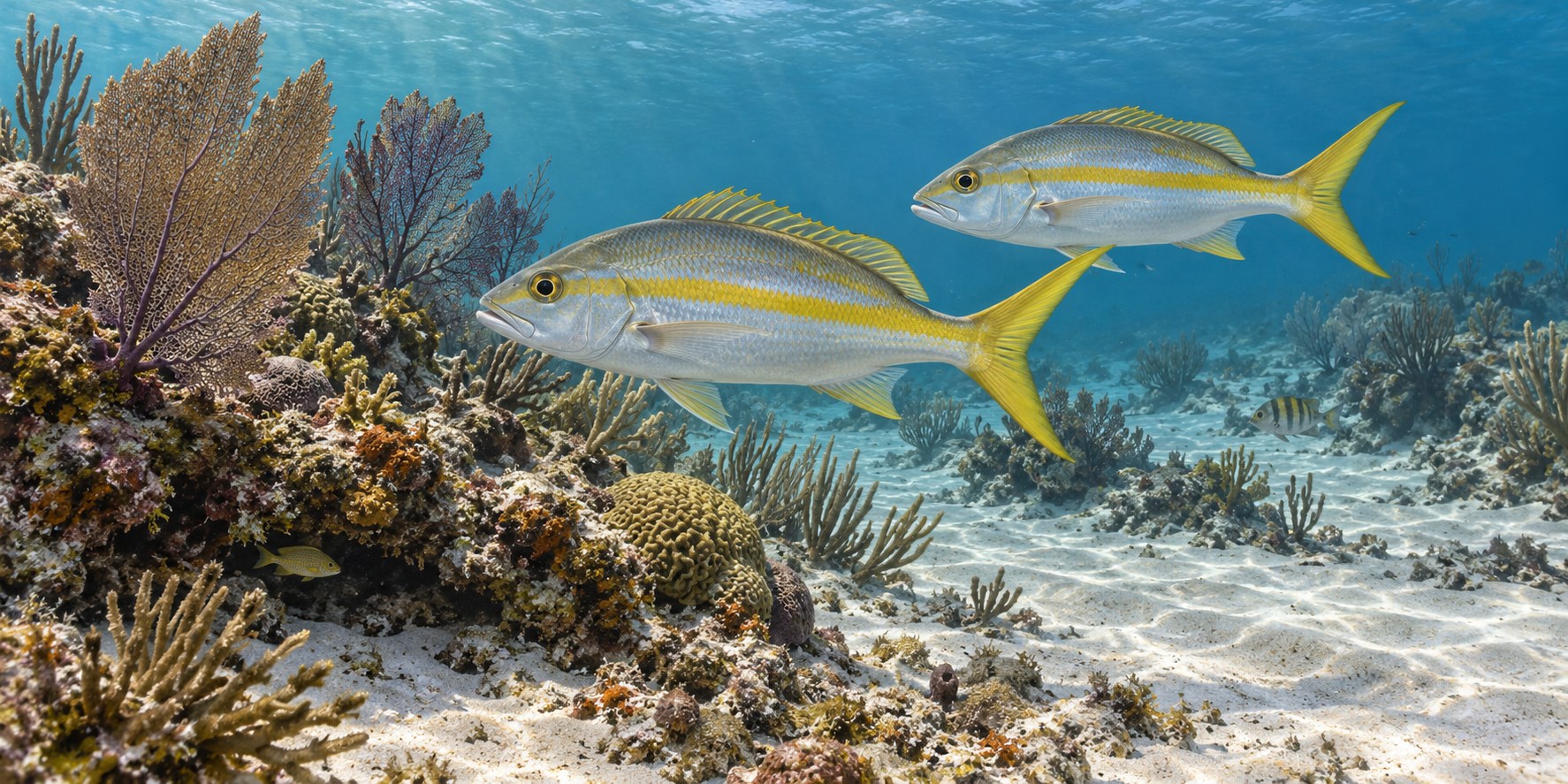
A legal patch-reef edge can place sand beside living structure. Small fish use the cover, while predators move along the boundary. Yellowtail snapper are one possible reef target where fishing is allowed and conditions suit the method.
Locate the exact sanctuary zone before deploying tackle. Some attractive reef areas prohibit fishing. An illustration of habitat does not identify a legal destination or replace a current chart.
Keep the boat and anchor away from coral. Plan the presentation so bait can move naturally without dragging hooks through living structure. If position cannot be maintained safely, choose a different legal area.
Targets for different kinds of Cudjoe trips
| Target | Habitat | Useful starting method | Main planning issue |
|---|---|---|---|
| Mangrove snapper | Legal mangrove or channel structure | Small shrimp or cut bait near cover | Access, depth and abrasion |
| Bonefish | Shallow feeding flat outside restrictions | Quiet shrimp imitation ahead of a visible fish | Approach and an undamaging route |
| Permit | Suitable sand-and-grass flat | Accurate crab-style presentation | Few chances and a careful release |
| Yellowtail snapper | Permitted reef water | Current-matched boat presentation | Marine weather and sanctuary boundaries |
| Barracuda | Clear channel or flat edge | Purposeful lure and leader choice | Safe handling of a strong toothy fish |
Choose one primary target and one realistic alternative. Carrying equipment for every species can distract from the route and method that actually fit the day.
Keep inshore snapper fishing precise
Place a small bait just outside cover and let it settle to the useful depth. Watch for short taps or a sudden change in line direction. Mangrove snapper can remove a loose bait quickly.
Reduce the bait size if the hook returns empty. Add only enough weight to control the drift. A rig pinned into rough bottom is difficult to fish and more likely to be lost.
Guide a hooked fish away from cover promptly with steady pressure. Check the leader after rubbing against roots or shell. A roughened section should be replaced before the next cast.
Use a landing arrangement that keeps the fish supported. Do not swing a larger fish onto a high dock or grab blindly near its mouth. Tools should be ready before the first bait goes in.
Make a flat observation before making a flat cast
Look for fish movement, disturbed bottom and small prey before casting. A pale sand opening beside grass can make a passing fish easier to see. Wait long enough to distinguish a moving shadow from a fixed patch.
Present ahead of the fish’s route. A heavy splash in shallow water can spoil the chance. Choose a lure weight that reaches the bottom gently rather than one selected for a deeper channel.
If visibility is poor, do not drive across the flat searching blindly. Switch to a known legal edge or end the sight-fishing portion. Avoiding habitat damage matters more than forcing the planned target.
Use the forecast for the full route
Check the Cudjoe-area tide and weather outlook with the return journey in mind. The outward drift may be easy because wind and current are helping you leave.
At low water, shallow banks can block a route that was comfortable earlier. At high water, hidden bottom features can still damage a propeller. Use navigation and depth information rather than water color alone.
For Atlantic trips, read the marine forecast beyond the sheltered shoreline. A calm canal does not describe the reef. Preserve a fuel margin and time for a slower return if seas increase.
How the year changes the decision
Winter fronts can limit open-water fishing and cool exposed flats. Seek a safe sheltered option only when the route remains manageable. Slower presentations near depth may suit fish that are less active.
Spring warming can improve shallow-water opportunities, but clear visibility and moderate wind are still important. Choose a day that lets you observe and learn rather than simply endure the conditions.
Summer adds strong heat and thunderstorm concerns. Keep a short backcountry route or an early offshore return. Carry drinking water and do not wait until a storm reaches the fishing position to begin moving.
Fall can offer changing bait movements and variable weather windows. Check ramp notices after significant weather and select the target from current conditions. A successful visit months earlier does not establish today’s route.
A first trip that leaves room for learning
Confirm the launch, select a nearby legal habitat feature and set a firm return time. Fish a channel edge before extending into a shallow area. This helps you understand current and boat control while still close to known water.
Keep notes about bait presence, depth and presentation. If the lure cannot stay in the intended lane, solve that before declaring the area unproductive. A small weight or angle change can be more useful than another mile of travel.
Finish with an orderly retrieval and equipment check. Knowing one dependable access arrangement and one manageable route makes future Cudjoe trips easier to plan.
Use state rules alongside area restrictions
Consult the FWC saltwater regulations for licenses, species identification and harvest limits. Refuge and sanctuary rules can further restrict locations and activities.
Keep released fish wet and supported. Avoid long fights on undersized tackle and relocate if predators repeatedly take hooked or released fish. Remove your line scraps and leave living habitat undamaged.
Decide on the fallback before leaving home
The uncertain ramp status makes an advance fallback especially valuable for a Cudjoe visit. Choose another confirmed facility with permission for your vessel and parking, then check whether the revised route still fits the weather and fuel plan. If it adds a long exposed crossing, it may no longer be a sensible substitute. A land-based day or a shorter outing from another island can be the better decision. Keep the launch contact and current notice available offline so the crew has the same information. Once on the water, use a similarly clear fallback: one sheltered nearby area and a firm return point. That reduces pressure to continue toward a distant reef merely because it was the original idea. Fishing plans work best when changing them does not feel like losing the entire day.
Cudjoe Key questions
Is Blimp Road definitely open?
The reviewed records include a 2026 temporary closure and an estimated reopening. Confirm the current status directly before relying on it.
Does the Venture Out photograph show public access?
No. It shows a private developed waterfront and is not a launch recommendation.
Can I land on any backcountry island?
No. Refuge and wildlife restrictions may close islands to landing. Check current boundaries and permitted access.
Where can I read the closure and habitat sources?
The Cudjoe Key reference notes include the county notice and official conservation information.