

FLORIDA KEYS & EVERGLADES
Harry Harris Park
fishing guide
Harry Harris Park is a Tavernier waterfront park with boat access and a protected swimming area. Its public shore is not one continuous fishing lane. Confirm the current authorized shoreline before choosing tackle or launching a boat.
Explore the guide ↓Use the public park in Tavernier
Harry Harris Park is at the end of Beach Road in Tavernier, near the Upper Keys portion of the Overseas Highway. It is a Monroe County park with waterfront recreation and a boat ramp. Use the public entrance and current county information rather than assuming a similarly named nearby property provides access.
Ask about parking, ramp operation, any resident or visitor fees and the current fishing boundary. Historical county planning identifies shoreline fishing locations, but that older document does not confirm every position is open now. The park also has a protected swimming area. Begin with the exact permitted place for your activity so the day does not turn into moving gear from one unsuitable corner to another.
Keep the protected swimming area free of tackle
The swimming enclosure and its rock protection serve people entering the water. They should not be treated as a casting platform merely because the stones look like fish habitat. Check posted rules and ask park staff where any permitted shoreline fishing begins.
Stay away from children, swimmers and people using the beach. An unused swim space can become busy in moments. Do not lower bait through gaps in an enclosure or cast over it to reach a darker patch. If the fishing permission remains unclear, use the park for a picnic or launch planning and choose a confirmed legal angling site elsewhere. Public shoreline access alone is not a complete fishing permission.
Give the boat ramp its own clear working space
A ramp is a route for launching and retrieving vessels, not an easy substitute for a fishing pier. Boats need room to approach, turn and load. Keep rods and hooks away from trailer lanes and do not block access while sorting tackle or waiting for a bite.
Prepare equipment before joining the launch line. Check the ramp's present condition and the depth your boat needs at the expected water level. Confirm parking arrangements for the towing vehicle and trailer. If a route leaves the park waters, carry a chart and check sanctuary boundaries before departure. The convenience of a ramp does not make every nearby flat, island or protected zone available for fishing or anchoring.
Recognize shallow edges without walking onto fragile bottom
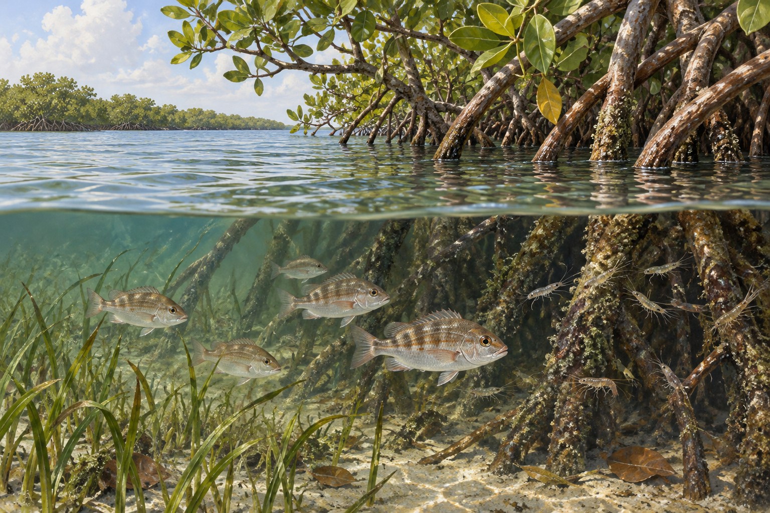
The Upper Keys combine shallow sand, submerged vegetation, mangrove cover and deeper connecting water. Small fish and crustaceans use these habitats in different ways. A clean sand margin beside shelter can help explain why predators travel a particular route.
Observe from an approved shore position or a safely operated craft. Do not assume that water close to shore has firm footing. Soft bottom, rocks and unexpected holes can make a short wade troublesome. Plants are important nursery habitat, so avoid dragging anchors or heavy tackle through them. A clear view should improve the choice of presentation rather than encourage a visitor to damage the cover that supports the fish.
Match the expected catch to the specific water
Mangrove snapper can use cover and harder edges, while jacks and barracuda may follow baitfish through more open water. Bonefish are associated with suitable flats in the wider Keys. These possibilities describe habitat, not a verified daily catch list for Harry Harris Park.
Begin with visible prey, accessible water and the park's approved boundary. A modest snapper-oriented plan needs different bait placement from a moving lure for a jack. Do not choose a large target simply because deeper water is nearby. Think about how the fish can be controlled and released without blocking the ramp or entering the swim area. The landing position should help determine the target.
Use shrimp and baitfish methods for different feeding clues
In an authorized sand-edge position, a small shrimp imitation can be worked with short lifts and pauses. Keep it above vegetation and avoid repeatedly dragging through roots. If the lure collects grass on every cast, alter its weight or the casting lane rather than pulling harder.
A compact baitfish lure can investigate open water where small fish are moving. Natural shrimp or a modest baitfish piece may suit a stationary approach when current permits. Check species and local method rules first. Buy or obtain bait legally; do not collect tropical fish from nearby habitat. Carry unused bait away in a closed container and remove line fragments immediately after changing rigs.
| Park area | Main use | Fishing planning |
|---|---|---|
| Protected enclosure | Swimming | Keep hooks outside the swim space |
| Boat ramp | Launch and retrieval | Do not occupy the working lane |
| Authorized shoreline | Angling where confirmed | Plan casts and release before rigging |
Bring a compact outfit and a working release kit
Shore anglers benefit from an outfit they can cast precisely without a long backswing. Use a leader suited to the expected fish and shoreline abrasion. A few reliable rigs are easier to manage in a public park than a large spread of open boxes and spare hooked lures.
Have pliers and a safe cutter ready before a fish arrives. Set the drag so the outfit works without an abrupt line break, and inspect the leader after contact with rough edges. Prepare a release from stable ground. Do not lift an uncertain fish onto a crowded path for identification. Keep wet hands and brief handling in mind, and consult current species rules before taking a catch home.
Check water level and weather before committing
Tide predictions help with timing, but wind can alter actual water level on a shallow Keys shoreline. Look at the ramp and access route as well as the fishing water. High water, flooding or slippery ground can limit the practical plan even when a preferred tide is approaching.
Summer brings strong sun and the chance of quickly developing storms. Cooler fronts can make an exposed launch or return route rough. Check the forecast for the whole outing, including the period after fishing. Do not wait for a storm to reach the park before securing a boat or packing rods. If conditions are marginal, a land-based visit is a sensible alternative to launching solely because the equipment is ready.
Make the park outing work for anglers and non-anglers
A group can use separate activities without mixing hooks into the swimming space. Decide who supervises children, where gear will be stored and when everyone meets again. Keep bait and sharp tools away from picnic food and public seating.
Bring water, shade needs and footwear for the actual route. A current county park improvement plan does not guarantee that every proposed facility is complete, so verify anything the group depends on. Record the permitted fishing position and ramp conditions for a later visit. Leave the park with the swimming enclosure, launch lanes and shore clear. A well-organized short session is more useful than a long one that creates conflict with other visitors.
Common questions
Is the swimming enclosure a fishing spot?
Do not treat it as one. Keep hooks away from swimming space and confirm a separate current authorized shoreline position.
Does the boat ramp mean I can fish from the ramp?
No. Launch and retrieval routes must remain clear. Ask about designated fishing space instead.
What does older county planning establish?
It identifies historical shoreline fishing locations. Current signs and county guidance still determine present use.
What should a boater check beyond park access?
Verify forecast, water level, ramp condition, return route and protected-zone boundaries for the actual trip.
Prepare for your visit
Check local tides and weather. Read more about mangrove snapper, permit, bonefish. Check current FWC saltwater fishing rules.