
FLORIDA KEYS & EVERGLADES
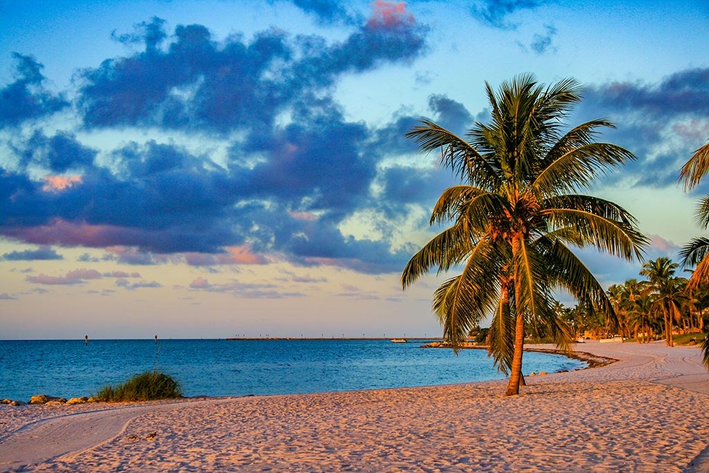
Smathers Beach
fishing guide
Smathers Beach is a broad Atlantic-side recreation beach in Key West. Its shallow water offers useful lessons about flats habitat. Confirm any angling permission separately, and keep the busy beach and swimming space clear of fishing tackle.
Explore the guide ↓Start with the city's public beach information
Smathers Beach runs along South Roosevelt Boulevard on the Atlantic side of Key West. It is a popular public beach used for swimming and other recreation. The city lists sunrise-to-sunset beach hours, with a separate restroom schedule.
Check current parking meters and signs when arriving. Rates, facility availability and activity rules can change, so plan around the present instructions rather than an old travel listing. Bring water and sun protection for the actual length of the visit. If angling is your main goal, ask the city about a current permitted area before bringing bait to the sand. The official beach description does not establish unrestricted fishing across the shoreline.
Give swimming and beach recreation clear priority
Smathers is not a place to infer casting permission from the size of the beach. A long shoreline can still have use restrictions. Ask for the precise current angling boundary and any time limits, and follow the posted rule even when a section looks empty.
Keep loose hooks and baited rigs away from walkers and people entering the water. Lines can be difficult for other visitors to see. A state license or release-only intention does not settle a local beach rule. If permission cannot be confirmed, make this a beach and observation visit, then choose an expressly authorized fishing destination. An attractive shallow flat is useful habitat, but habitat and public angling permission are different questions.
See how sand and vegetation divide the shallows
The shallow Atlantic setting can contain pale sand lanes, darker submerged plants and small changes in bottom level. Those differences influence where prey hides and moves. A sand edge beside cover may be more informative than a distant patch that simply looks deeper.
Observe from a permitted viewing route and allow the eyes to adjust to glare. Polarized glasses can help, though they cannot reveal every hazard or identify every fish. Do not walk through seagrass to obtain a clearer view. Small animals depend on that cover. The beach offers a way to learn why a living flat is valuable without digging, collecting bait or placing a lure into recreation space.
Watch small prey before looking for large fish
Shrimp, crabs and small fish support many larger coastal species. Notice whether small fish stay close to cover, cross a bare lane or gather in response to disturbance. Those actions can explain a feeding route more clearly than a single large shadow passing through.
Do not feed wildlife to create an encounter. Bread, scraps and discarded bait change natural behavior and can attract animals into crowded areas. Use observation or a respectful photograph instead. A quiet period may reveal details missed during constant movement. The lesson to carry away is how prey uses shelter at the current water level, not a claim that every visible patch should be fished.

Connect possible flats species with the right food
Bonefish use suitable shallow flats to search for small prey, while permit can seek crabs and other crustaceans. Barracuda pursue fish, and jacks may follow schools through open water. These are wider Keys habitat relationships rather than a verified daily species list at Smathers.
Identification should depend on a clear view of shape and behavior. A ray or a shadow can be mistaken for a feeding fish at a distance. Avoid approaching wildlife or entering deeper water merely to confirm a name. Where a species is seen in a recreation area, watching is the appropriate activity until any separate fishing permission is established. A sighting is useful knowledge without requiring an immediate cast.
Use the observations at an authorized fishing site
At a legal flats location, a small shrimp imitation can imitate prey crossing open sand. Place it ahead of a fish rather than directly beside it. Keep movement restrained and the weight light enough to avoid dragging through plants. A different prey pattern may call for a compact baitfish imitation instead.
Legally obtained natural bait can be useful where local and species rules permit it. Bonefish must be released under Florida regulations, and gear requirements deserve attention before the trip. Prepare a suitable outfit and release tools for the actual authorized site. Do not try these techniques from Smathers while waiting to learn its rule. The beach provides habitat lessons; the confirmed fishing position determines how they may be applied.
| Observation | Fishing lesson | Beach limit |
|---|---|---|
| Sand beside plant cover | Prey travel lane | Do not trample vegetation |
| Changing water level | Available feeding space | Stay on a safe permitted route |
| Moving baitfish | Possible predator route | A sighting does not grant casting permission |
Compare the forecast with the visible shoreline
Higher water can cover feeding space and allow small animals to spread out. Lower water may expose sand and concentrate movement along remaining wet routes. Watch a fixed edge and note changes rather than relying entirely on the predicted tide time.
Wind can alter the actual level and stir shallow bottom. A darkened shoreline after a windy period may be suspended material rather than increased depth. Do not wade farther out to compensate for a falling level or a poor view. The return route can differ from the outward walk. Tide learning at the beach is most useful when it happens from stable permitted ground with no pressure to reach a distant fish.
Plan an Atlantic-side visit with an early exit option
The broad beach can be exposed to sun and wind. A pleasant breeze does not remove the need for water and protection. Keep the first visit short enough that children and non-anglers remain comfortable, especially during warm periods.
Summer storms can build rapidly around an otherwise inviting beach day. Cooler fronts may bring rougher water and persistent gusts. Follow current warning signs and leave open space before threatening weather reaches the shore. Do not confuse clear water with safe conditions for a small craft. If a rental or launch is part of the outing, confirm its operation, weather limits and return arrangements directly rather than assuming the beach itself guarantees access.
Pair the beach with a clearly planned angling outing
A Smathers visit can teach the shallow Atlantic habitat before a separate fishing session. Fort Zachary Taylor identifies a west-side channel fishing area, with its own entry requirements and current boundaries. Other Lower Keys options also need individual permission and access checks.
Keep the two plans realistic about travel, parking and time. Store rods securely during beach recreation and avoid leaving bait in a hot vehicle. Record the prey movement, wind and water level observed at Smathers. Those notes can guide later tackle choices without claiming that the beach was an authorized fishing site. Finish with all line, packaging and food waste removed so the shared shoreline remains welcoming.
Common questions
Can I assume fishing is allowed anywhere along Smathers?
No. Confirm the exact current city rule and any authorized area before casting. Keep swimming and recreation space clear.
What can the shallow water teach an angler?
Observe sand lanes, plant cover, small prey and changes in water level. Apply those lessons at a legal fishing site.
Is a tide prediction enough to judge local conditions?
No. Wind, water clarity, warnings and the actual shoreline level also matter.
Which separate park identifies a fishing area?
Fort Zachary Taylor visitor information identifies its west-side channel area. Check present park access and boundaries before using it.
Prepare for your visit
Check local tides and weather. Read more about permit, bonefish. Check current FWC saltwater fishing rules.