
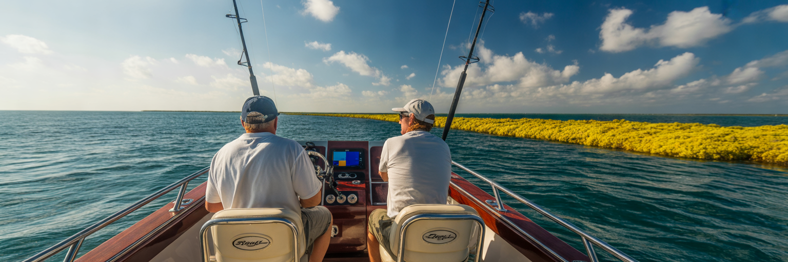
The Gulf Stream pushes roughly 800 million cubic feet of warm water per second through the Florida Straits, turning the waters off the Keys into a high-speed pelagic highway every spring. Knowing how to read that moving water separates crews that come back to the dock with a full fishbox from those burning fuel in an empty ocean. Relying on a static Florida Keys mahi calendar without checking real-time water movement is the fastest way to waste a tank of gas.
Using a Florida Keys Mahi Calendar for Spring Runs
Spring in the Keys is a transitional battleground where late winter frontal remnants collide head-on with warming Gulf Stream water. If you treat March, April, and May like a fixed schedule on a wall, you will miss the bite entirely. Success in spring mahi fishing Keys waters comes down to pairing seasonal migration patterns with live environmental triggers. You have to combine calendar timing with active water-reading skills, which sits at the core of our pillar guide on mahi mahi fishing across the state.
The 78 to 84 Degree Thermal Trigger
Everything offshore revolves around water temperature. As late March rolls into April and May, sea surface temperatures climb into the 78 to 84 degree Fahrenheit window. That thermal shift acts as an immediate biological trigger for the entire pelagic food chain. Once the water hits 78 degrees along the outer reef edge and offshore humps, ballyhoo and flying fish push out of deeper thermal layers and stack along surface current seams. Mahi track these bait migrations with ruthless efficiency. When you watch your transducer temperature reading jump from 76.5 to 79 degrees over a half mile run, you are crossing the exact boundary where hungry gaffers stage to ambush bait.
Spring Conditions Versus Summer Doldrums
Any veteran captain will tell you that spring runs require a tougher stomach than the mid-summer doldrums. July and August offer glass-calm mornings and endless packs of 22-inch peanuts under every scrap of grass, along with twenty boats fighting over the same weed line. Spring deals a very different hand. You will face stiffer breezes, lumpier seas, and much wider gaps between fishable structure. Yet the reward for picking your weather window in the spring is a significantly heavier average class of fish and wide-open ocean with minimal boat traffic.
The biggest mindset shift you need to make this season is ditching waypoint fishing for condition hunting. Pelagic structure moves north at three to four knots inside the Gulf Stream. Yesterday’s hot GPS numbers from a buddy at the dock are completely useless by sunrise today because that specific body of water is now seventy miles up the coast off Palm Beach. Stop steering toward fixed coordinates on your chartplotter and start hunting the moving water mass itself.
Month by Month Breakdown from March Through May
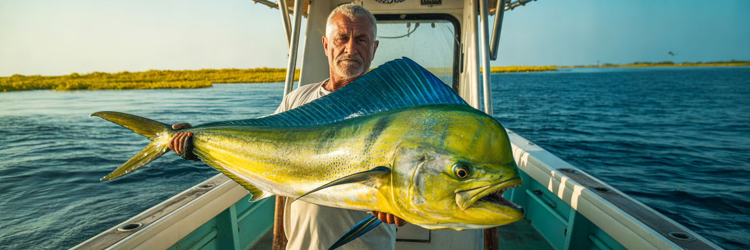
While daily wind and current dictate where the fish sit on a given Tuesday, the biological progression from March through May follows a clear pattern. Understanding what class of dolphin is moving through the Straits each month helps you rig the right tackle and set realistic goals before leaving the slip. For visiting anglers or boatless crews weighing April trophy bulls against May schoolie numbers, our breakdown on when to book a mahi charter maps out how top local captains schedule around these windows.
March Pre-Spawn Push on the Reef Edge
March marks the opening bell for the pre-spawn push. Late-season cold fronts still sweep down the state, followed by brisk northeast and east-northeast winds. While those fronts chop up the Hawk Channel run, they also pin the western edge of the Gulf Stream tight against the outer reef tract. You do not need to run thirty miles to find fish in March. Look for sharp color changes where milky turquoise reef water slams into dark cobalt blue just 6 to 12 miles offshore. Early-season packs of 10 to 15 pound gaffers ride these thermal breaks, feeding aggressively on ballyhoo flushed off the reef edge.
April Trophy Season for Slammers and Bulls
If your goal is putting a thirty-pound bull on the deck, circle April in red ink. April consistently produces the heaviest slammers and paired-up bulls and cows of the entire year. Because massive summer sargassum mats have not yet formed and organized in the Straits, these big tournament-grade fish concentrate tightly around whatever isolated cover they can find. A single floating pallet board, a waterlogged palm trunk, or a sharp current rip in 600 to 900 feet of water will hold trophy fish that have seen very little angling pressure since winter.
May Peak Transition and Schoolie Volume
By May, the prevailing winds clock steadily to the southeast and water temperatures lock in above 80 degrees. This is the peak volume transition. Massive mats of sargassum pushed out of the Caribbean and Gulf begin forming long, defined highways running parallel to the Keys. High-volume schools of legal peanuts mixed with solid 12 to 20 pound gaffers flood the Straits. You will cover more water in May as the stream settles into its late-spring pattern, but once you locate a live weed line, the action is fast and chaotic.
Adjusting for Full Moon Lockjaw
Even a textbook May forecast can humble a crew right after a bright full moon. Dolphin are visual predators with huge eyes built for low-light hunting. Under a clear full moon, they gorge all night on flying fish and squid rising to the surface. When you pull up to a prime weed line at 7:30 AM the morning after a full moon, those fish are often stuffed to the gills and suffering from complete lockjaw. Instead of quitting by noon, shift your schedule. Sleep in, let the fish digest through the morning, and work the 11:00 AM to 4:00 PM afternoon bite when the moon sets and their metabolism fires back up.
Spring Mahi Monthly Progression in the Florida Keys
| Month | Typical Sea Temp (F) | Dominant Fish Class | Primary Holding Structure | Typical Run Distance |
|---|---|---|---|---|
| March | 74 to 77 degrees | Scattered gaffers (8 to 15 lbs) | Sharp color edges and temperature breaks | 6 to 12 miles |
| April | 78 to 81 degrees | Trophy bulls and cows (20 to 40+ lbs) | Isolated floating debris and current rips | 10 to 20 miles |
| May | 81 to 84 degrees | High volume schoolies and gaffers (5 to 20 lbs) | Organized sargassum weed lines | 12 to 25+ miles |
This table summarizes historical spring offshore logs and water temperature averages across the Florida Straits, helping crews match their tackle and fuel range to the specific month they plan to fish.
How Wind Direction and Gulf Stream Current Shape the Bite
Temperature brings the fish into the neighborhood, but wind and current build the house they live in. Mastering Gulf Stream mahi tactics requires understanding the physical oceanography of the Florida Straits before you ever untie the dock lines. The relationship between surface wind vectors and the north-flowing current determines whether you spend your morning working a tight, productive edge or wandering through a featureless desert.
Gulf Stream Eddies and the Northern Wall
The northern wall of the Gulf Stream acts as a giant conveyor belt sweeping from west to east past Key West and Marathon before curving northeast past Islamorada and Key Largo. Along the inshore boundary of this wall, friction against the continental shelf spins off counter-clockwise eddies. When a large eddy peels off the main current, it can shove gin-clear cobalt water right up to the 200-foot drop off Islamorada, or pull the clean water twenty-five miles offshore of Marathon. Tracking where that wall sits relative to your home inlet is half the offshore battle.
The East Wind Advantage Versus West Wind Slicks
Here is the classic offshore angler’s dilemma: the weather that feels great on your back is usually terrible for catching mahi. A sustained 15-knot east or southeast breeze blowing for two to three consecutive days is pure gold in the spring. That onshore push works against the side of the Gulf Stream, compacting scattered sargassum, bamboo, and bait into tight, organized rips while pushing the main current edge closer to the reef. Yes, you will take spray over the bow on the way out, but the fish will be stacked in a narrow corridor.
Compare that to a multi-day west wind or a week of glass-calm slick conditions. Without an easterly push, the Gulf Stream axis drifts 20 miles or more offshore and the sargassum mats blow apart into useless, dime-sized patches. Worse yet, flat-calm water lets dolphin see your boat hull, outriggers, and heavy fluorocarbon leaders from fifty feet away, turning aggressive eaters into spooky window shoppers.
Navigating Wind Against Current in the Straits
While an east-southeast breeze helps you, a late-spring northeast blow requires serious caution. Because the Gulf Stream flows north and northeast through the Upper and Middle Keys, a stiff northeast wind blows directly against the oncoming current. Wind against a 3.5-knot current stacks up steep, closely spaced, square waves that can turn an easy 12-mile run into a dangerous washing machine in minutes.
Before committing to a trip, check the 48-hour wind history at the Sombrero Key or Molasses Reef weather buoys. If the wind has held between 90 and 150 degrees at 12 to 18 knots for two days, expect packed weed lines within fifteen miles of the reef. If the buoy shows north-northeast gusts above 18 knots, leave the offshore rods in the rack and fish the backcountry bridges.
Pre-Trip Recon Signs to Monitor Before Leaving the Dock
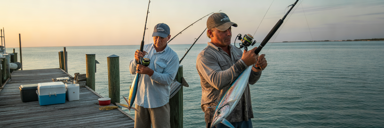
Knowing how wind and current interact offshore is only useful if you verify what is actually happening the night before your trip. Smart captains do their homework at the kitchen table using digital recon tools and local dock intelligence to make a disciplined go or no-go call.
Reading SST and Chlorophyll Satellite Imagery
Start by pulling up high-resolution Sea Surface Temperature (SST) and chlorophyll satellite shots before fueling the boat. Because spring water temperatures still fluctuate, SST maps reveal sharp thermal breaks where 75-degree coastal water meets 80-degree Gulf Stream eddies. Pair that thermal map with a chlorophyll overlay, which is often less obscured by spring cloud cover. Chlorophyll imagery measures microscopic algae concentrations, allowing you to pinpoint the exact density edge where turbid green reef water collides with nutrient-poor cobalt blue water. Mark the latitude and longitude of that boundary line on your plotter so you have an immediate starting depth at dawn.
Wave Height Versus Wave Period Math
Never look at forecast wave height in isolation. The real measure of sea comfort and safety lies in the ratio between wave height in feet and dominant wave period in seconds. A forecast calling for 3-foot seas sounds manageable at first glance. However, if those 3-foot waves are stacked at a 4-second period, you are running into a steep, kidneys-bruising chop that forces you off plane. Conversely, a 3-foot swell spaced out over a 9-second period offers a gentle, rolling ride where you can cruise comfortably at 28 knots. Always aim for a wave period at least double the wave height before clearing the inlet in a center console.
Using Tide Charts and Local Dock Intel
Satellite passes can be twelve hours old by the time you launch, so cross-reference your digital maps with real-time regional fishing reports on HookCurrent and afternoon dock talk at the cleaning tables. Find out the exact depth where charter boats crossed the color edge at 2:00 PM the day prior, whether it sat tight on the 300-foot drop, over the Islamorada Hump, or way out in 1,200 feet.
Do not overlook inshore water movement when planning an offshore run. Checking our guide to reading fishing tide charts will show you when strong outgoing tides flush warm, murky Florida Bay water out through wide channels like Snake Creek, Whale Harbor, and Vaca Cut. Two hours after a heavy falling tide, that dirty bay water pushes past the outer reef and forms distinct nearshore rip lines and color edges in 150 to 300 feet of water, creating an ambush point for early-morning gaffers right out front.
Run through this four-point pre-departure checklist the night before every spring trip:
- Verify the Wave Ratio: Confirm the dominant wave period in seconds is at least twice the significant wave height in feet, with zero northeast wind components exceeding 15 knots.
- Pinpoint the Density Edge: Overlay the latest SST and chlorophyll charts to identify the exact depth contour where green coastal water meets the 78-plus degree Gulf Stream wall.
- Check the Buoy History: Review the past 36 hours of wind direction at Sombrero Key or Molasses Reef to confirm an easterly vector has compacted the sargassum lines.
- Confirm Yesterday’s Depth: Cross-check afternoon dock reports and tide charts to see if the bite held tight to nearshore tide rips or required a deep run past the humps.
Planning Departure Windows and Managing Offshore Run Distance
Once your recon confirms a green light, execution comes down to time management, fuel math, and geography. Successful offshore fishing Florida Keys trips are built around realistic running distances and sun angles rather than blind races to the horizon.
Dawn Patrol Versus High-Sun Visibility
Every crew debates the classic dawn patrol versus a mid-morning departure. Clearing the inlet at first light puts you on the offshore humps before boat traffic builds and gives you a calmer morning ride before the afternoon thermal sea breeze kicks up. That early start works great if you are running straight to fixed bottom structure like the Islamorada Hump or Marathon West Hump to catch live blackfin tuna and skipjack for bait.
However, if your game plan revolves around visual hunting for floating debris and subtle color changes, leaving the dock at 5:30 AM puts you on the grounds in the dark when you cannot see fifty yards ahead. Waiting to clear the pass around 7:30 or 8:00 AM gives you a higher sun angle behind your back. With the sun up and a pair of amber or copper polarized glasses on your face, you can spot floating pallets, current seams, and color changes from half a mile away instead of driving right past them in the gray dawn glare.
Fuel Math and Structuring 6 to 8 Hour Windows
Miscalculating fuel burn is the quickest way to cut a spring trip short. Running 15 miles south to a rumored weed line is only a fraction of your daily mileage. Because spring structure is often scattered, you must budget an additional 30 to 40 miles of active running and gunning once you reach blue water to track down live birds and productive debris.
Structure your trip duration around where the edge sits. A 6-hour fishing window works well when three days of east wind have stacked the current edge in 350 to 500 feet of water just eight miles off the reef. When light winds allow the main current axis to slide out into 800 to 1,500 feet of water beyond the humps, an 8-hour commitment is mandatory to cover the run out, hunt laterally across the current, and make it back before dark.
Regional Run Distances Across the Keys
Your home port dictates your baseline run distance because the underwater shelf widens as you travel down the island chain. In the Upper Keys off Key Largo, the reef tract sits close to shore and the bottom drops into blue water rapidly. As you move down to Marathon and Key West, the hawk channel and reef shelf stretch out, requiring longer runs to reach the 1,000-foot contour.
Regardless of your port, always plot an angled course up-current (southwest) on your morning run out. As you troll and work weed lines throughout the day, the 3-knot north-bound Gulf Stream will naturally drift your boat back toward your home inlet, allowing you to ride a comfortable following sea home in the afternoon.
Offshore Run Distances and Depth Contours by Keys Region
| Keys Region | Distance to 300 Foot Drop | Distance to 1000 Foot Grounds | Primary Offshore Landmark | Recommended Trip Window |
|---|---|---|---|---|
| Upper Keys (Key Largo) | 5 to 7 miles | 12 to 15 miles | The Elbow and Carysfort Trench | 6 hours minimum |
| Middle Keys (Islamorada to Marathon) | 6 to 9 miles | 15 to 22 miles | Islamorada Hump and Marathon West Hump | 6 to 8 hours |
| Lower Keys (Big Pine to Key West) | 8 to 11 miles | 18 to 25+ miles | Woods Wall and Key West Bar | 8 hours minimum |
Distances are measured in nautical miles from primary oceanside passes such as Tavernier Creek, Whale Harbor, Vaca Cut, and Key West Main Ship Channel based on NOAA bathymetric charts.
Before coming off plane on your first stop, set a hard turn-around time with your crew and enforce the strict one-third fuel rule: use one-third of your tank for the run out and hunting, one-third for the run home, and keep a full one-third in reserve for unexpected weather or heavy following seas.
Reading the Water and Hunting Structure on the Grounds
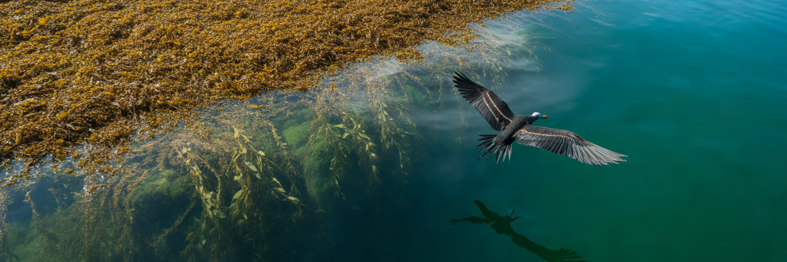
Once you cross into blue water, take your eyes off the GPS screen and put them on the horizon. Effective targeting mahi on weed lines and open-water structure is an active visual hunt. Most recreational crews waste hours pulling dead ballyhoo through lifeless water simply because they do not know how to grade the structure in front of them.
The Visual Hierarchy of Floating Debris
Not all floating cover is created equal, especially in March and April. When sargassum is scarce, hard floating debris sits at the very top of the pelagic food chain. A single floating five-gallon bucket, a tangled ball of commercial poly rope, a wooden shipping pallet, or a waterlogged palmetto frond drifting in 700 feet of water will hold more big gaffers and trophy bulls than five miles of sterile, freshly blown sargassum. Hard objects stay together in rough seas, accumulate thick colonies of barnacles and baitfish over weeks at sea, and cast a solid shadow that attracts wary 30-pound bulls.
Decoding Frigatebirds and Working Terns
Your best radar system offshore has feathers. A seasoned crew scans the sky constantly with stabilized binoculars to spot bird activity from two miles out. Learn to read the body language of a magnificent frigatebird. If a frigate is circling high in the clouds on motionless wings, he is just riding thermals and searching the ocean like you are. Keep moving.
When that same frigate drops down below a hundred feet, folds his wings back, and begins swooping erratically over a tight patch of water, push the throttles forward. He is tracking a predator pushing bait to the surface. Better yet, look for flocks of white royal terns or dark noddy terns diving aggressively and picking micro-bait off the surface along a current seam. Terns rarely lie; when they are diving fast and moving north with the current, feeding schoolies or gaffers are almost always underneath them.
Evaluating Live Versus Dead Weed Lines
When you pull up to a sargassum line in May, do not immediately drop six lines in the water. Take sixty seconds to inspect the grass and determine whether it is alive or dead. A dead weed line consists of thin, bright yellow, freshly broken sargassum scattered loosely on the surface with zero bait presence. Trolling a dead line for two hours is just washing lures.
A live weed line has vertical thickness where mature, dark brown sargassum hangs two to three feet down into the water column. Look for clear signs of an active ecosystem: foam and bubbles trapped in the current seam, tiny silver baitfish dimpling the surface, juvenile ocean triggerfish and filefish darting into the stalks, and flying fish flushing out in front of your bow.
Use a disciplined run-and-gun approach between patches. Cruise at 25 knots along the edge until you spot working birds, hard debris, or a thick, live weed mat. Only drop the outriggers and slow-troll at 6 to 7 knots when you confirm bait and life in the water.
Assign every person on board a specific watch sector so nothing slips past the boat:
- Bow Watch: Stands forward of the console with polarized glasses scanning directly ahead for submerged timber, poly balls, tripletail, and flushing flying fish.
- Helm Watch: Monitors the horizon with stabilized binoculars for low-swooping frigatebirds while watching the transducer screen for sudden half-degree temperature spikes and suspended bait marks.
- Cockpit Watch: Scans ninety degrees off both port and starboard beams to spot parallel current rips, color changes, and diving terns that the helm might miss.
Tackle Setups and Boat Deck Tactics for Spring Mahi
Finding the fish is eighty percent of the work, but clean deck execution is what fills the icebox. When a pack of lit-up neon green and gold mahi charges your transom, tangles and poorly rigged tackle will cost you half the school in seconds. Keep your spread simple, keep your spinning rods ready, and execute like a seasoned charter mate.
Building a Four to Six Rod Spring Trolling Spread
You do not need ten rods dragging behind a center console to catch spring dolphin. A tight, tangle-free four to six rod spread lets you make sharp turns on floating debris and clear lines quickly when a big fish eats. Set your short corners flat in the clean lanes right behind the prop wash: run a deep-diving lipped plug on one side and a #4 planer or heavy troll weight ahead of a strip bait on the other to cover the 15-foot depth zone.
On your port and starboard outriggers, pull rigged medium ballyhoo paired with small blue-and-white or pink chugger heads so they pop and leave a smoke trail every third wave. Down the center, send a naked split-tail mullet or a small feathered jet way back in the shotgun position well behind the boat wake. Big April bulls frequently hang back behind the main spread, and that long shotgun bait is consistently the top producer for trophy fish. For a complete breakdown on skirt colors, head shapes, and rigging weights, check out our guide to mastering trolling lures for mahi.
Spinning Gear and the Keep One in the Water Rule
The biggest mistake novice crews make is treating mahi purely as a trolling species. The trolling spread is just your search tool to locate the school. Once a trolling rod bends over, the real work shifts to your spinning tackle. Keep two to four heavy-duty 5000 to 6000 size spinning reels, such as a Shimano Stella SW 6000XG, racked on the gunwales within arm’s reach. Spool them with 20 to 30 pound high-visibility braid topped with four feet of 40-pound fluorocarbon leader and a 5/0 or 6/0 inline circle hook. Our tackle guide on dialing in braid for Florida mahi fishing covers why high-vis line is vital for tracking crossing fish around the engines.
As soon as you hook a fish on the troll, pull the throttles back to idle and reel that first mahi up within fifteen feet of the transom, then leave it in the water. Never gaff or boat the first fish immediately. Mahi are fiercely competitive pack feeders; leaving one hooked fish flashing and swimming behind the engines holds the entire school right under your hull. While one angler manages that decoy fish, the rest of the crew grabs the spinning rods, tosses a handful of cut bonito chunks or glass minnows into the prop wash to get the school firing, and pitches hooked baits straight into the frenzy. Always keep at least one hooked fish swimming in the water until the icebox is full or the school moves on.
Finesse Adjustments for Lockjaw Bulls
Sooner or later in April or May, you will run across a pair of 25-pound bulls swimming casually under a floating pallet that refuse to touch your trolling lures or heavy pitch baits. When big spring fish have lockjaw, heavy tackle is your enemy. Put away the 80-pound mono leaders and wire rigs.
Grab a spinning rod, tie on six feet of 30-pound fluorocarbon leader using a slim Alberto knot, and bury a small, light-wire 4/0 or 5/0 circle hook completely inside a fresh three-inch chunk of bonito belly or a whole peeled squid. Better yet, nose-hook a live pilchard or cigar minnow from your livewell and free-line it back toward the structure with the bail open so it drifts naturally at the exact speed of the current. Without the unnatural drag of heavy leader or lead weight, even the most educated full-moon bull will rarely pass up an easy, slow-sinking meal.
Before you drop the lines on your first weed line of the morning, run through this final cockpit readiness checklist:
- Gaffs Uncapped and Accessible: Stage a 6-foot gaff with a 3-inch hook in the gunwale rack with the point protector removed so no one is fumbling when a 30-pound bull comes alongside.
- Pre-Cut Bait Chunks: Slice two dozen one-inch chunks of bonito belly, ballyhoo, or squid and keep them in a wet plastic tray on the transom well before you hook your first fish.
- Spinning Rods Cocked: Pre-bait two spinning rods with bucktail jigs or fresh strip baits, set the drags to eight pounds of strike pressure, and hook them lightly to the reel seat frame.
- De-Hookers and Fishbox Clear: Clear all gear Bags off the fishbox hatch lid, slush the ice down with two buckets of seawater, and keep a long-handled de-hooker on the console to release undersized peanuts quickly in the water.