Skip to content

HOOKCURRENT FLORIDA FISHING

Florida Fishing Locations

Find a place to fish. Learn what bites, which bait to bring and where to begin.

Choose a town or beach to see its fishing guide.

Find your location A-Z

See the newest guides

The letters follow the name of each town, beach, island or park, not its county. For example, Destin is under D and Clearwater Beach is under C. Choose a letter to jump to the full list below the latest guides.

Latest fishing guides

People and dogs on the tidal shore at Lee County Dog Beach

Dog Beach Park Fishing Guide

Dog Beach Park is a tidal shoreline on the Bonita Beach Causeway used by people and their dogs. It should not be treated as a ready-made fishing station. Confirm angling permission, keep hooks away from animals and choose another authorized shore if the shared space or tide prevents a safe fishing visit.

Read the fishing guide
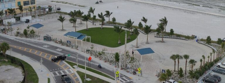
Aerial view of lawn and shoreline at Crescent Beach Family Park

Crescent Beach Family Park Fishing Guide

Crescent Beach Family Park is a compact Fort Myers Beach access near the foot of Matanzas Pass Bridge. It reopened on July 29, 2026, under the county notice. Fishing is listed, but a busy family beach calls for a small attended setup and a casting lane well away from swimmers and foot traffic.

Read the fishing guide
Rocky shoreline beside the Sanibel Causeway Islands

Causeway Islands Fishing Guide

The Sanibel Causeway Islands are two public shore areas along the connection between the mainland and Sanibel. Fishing is listed as an activity, but the current county page prohibits launching or retrieving vessels. Plan a shore visit, watch channels and wakes, and keep every line clear of vehicles and other visitors.

Read the fishing guide
Mangrove edge and shallow water at Bunche Beach

Bunche Beach Fishing Guide

Bunche Beach is a natural mainland shoreline on San Carlos Bay near the Sanibel Causeway. Its shallow tidal setting is different from a breaking Gulf surf beach. Work with water level, protect the flat and choose an allowed open casting lane instead of treating the exposed sand as a route to deeper channels.

Read the fishing guide
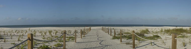
Roped beach path across dunes at Bowman's Beach Park

Bowman's Beach Park Fishing Guide

Bowman’s Beach Park is a Gulf beach access on Sanibel, with a walk between the parking area and the sand. The county owns the park and the City of Sanibel operates it. A deliberate surf-fishing kit makes that walk easier and leaves room for the other people enjoying this broad shoreline.

Read the fishing guide
Aerial view of Bowditch Point Park buildings and coastal water

Bowditch Point Park Fishing Guide

Bowditch Point Park sits at the north end of Estero Island, where Gulf beach and bay-related water create different fishing situations. A current construction notice closes its parking and amenities. Pedestrian beach entry remains available, so settle the walk and permitted fishing position before planning tackle.

Read the fishing guide
Aerial view of Bonita Beach Park facilities and Gulf shoreline

Bonita Beach Park Fishing Guide

Bonita Beach Park serves the Gulf shoreline at the south end of Hickory Island. Its parking and amenities are closed for storm-repair construction under the current county notice. Pedestrian beach access remains a different question, and marked swimming areas are excluded from fishing.

Read the fishing guide
Mangrove shoreline and water at the east end of Andy Rosse Lane

Andy Rosse Lane Park Fishing Guide

Andy Rosse Lane Park is a pedestrian beach access on Captiva. The west end reaches the Gulf, while the east end is not recommended for paddlecraft launching. With no park parking listed, the first task is arranging a lawful arrival before carrying a small fishing kit to an allowed shore position.

Read the fishing guide
Picnic tables and Gulf beach at Alison Hagerup Beach Park

Alison Hagerup Beach Park Fishing Guide

Alison Hagerup Beach Park gives public access to the Gulf near the north end of Captiva. It is a small shared beach with substantial parking costs and important wildlife rules. Keep the fishing plan simple, attend every rod and settle the allowed casting space before buying extra time.

Read the fishing guide
Vanderbilt Beach shoreline with buildings beyond the sand

Vanderbilt Beach Fishing Guide

Vanderbilt Beach is a popular Naples Gulf shoreline at the west end of Vanderbilt Beach Road. A useful fishing visit starts with a permitted casting area and enough room around beachgoers. Read the nearshore sand, pack compact tackle and keep the busy public access clear.

Read the fishing guide
Aerial view of Tigertail Beach lagoon and outer Gulf shoreline

Tigertail Beach Fishing Guide

Tigertail Beach joins a developed park to tidal lagoon habitat and the outer beach of Marco Island. Birds use the lagoon and Sand Dollar Island area, while the walking route can be long. Choose an allowed fishing section without wading an uncertain lagoon shortcut.

Read the fishing guide
Marco Island resort shoreline in evening light, shown for wider island context

South Marco Beach Fishing Guide

South Marco Beach gives visitors a public route to the Gulf shore of Marco Island. The walk from the county parking area crosses a busy developed beach district. Confirm local fishing rules, bring bait and choose a clear dry-sand lane away from swimming activity.

Read the fishing guide

All fishing locations A-Z

Browse by the place name. The region and county appear beneath each name to help you find the right area.

276 fishing guides

A

B

C

D

E

F

G

H

I

J

K

L

M

N

O

P

R

S

T

U

V

W